River/Stream: Wapsipinicon River
Location: Troy Mills, Linn County
Latitude: 42.288219
Longitude: -91.682695
Built: 1905; reconstructed in 1989 with unpermitted repairs in 2006
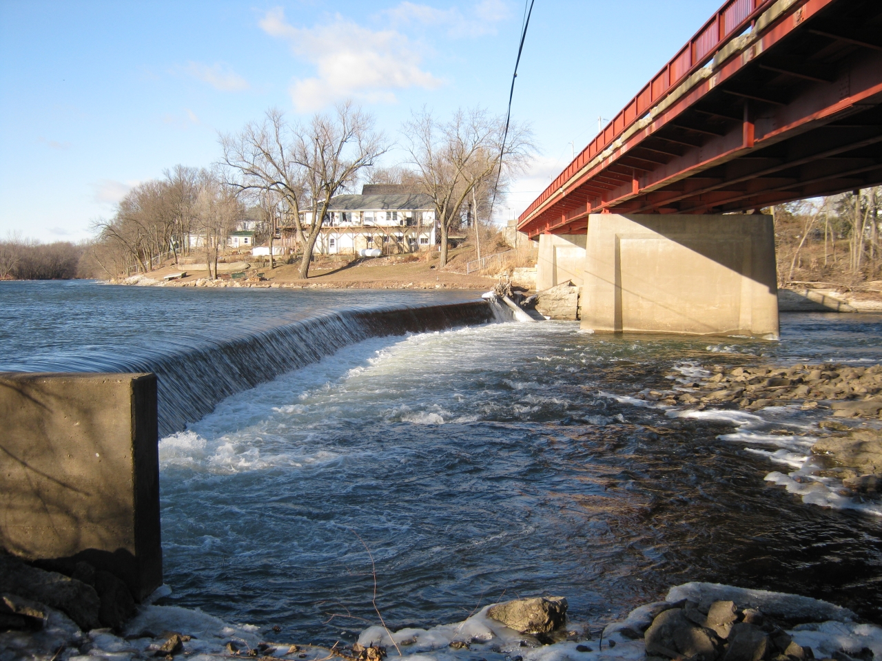
Owner: Troy Mills Dam Association
Height: 6 ft.
Length: 280 ft.
Hazards: drowning, visibility, varying, usage, debris
Warning Signs:
Portage:
Comments: currently in poor condition. The Iowa DNR has a plan to mitigate the dam with a rock arch rapids. Anticipated project completion date is spring 2018.
Fatalities 1
- July 19, 2014 - Andrea Zimmermann, went over the dam while tubing

Photos courtesy of Dave Hillman