The Cedar Falls Whitewater park is located on the Cedar River in Cedar Falls, Iowa. It is a “park & play” spot in the Cedar Falls Gateway River Park Complex. The whitewater park mitigated a former beautification dam associated with the Clay Equipment Company. Read more about the history of the Cedar Falls dams on the Cedar Falls Dam page. The whitewater park was completed in 2025. The venue is comprised of 4 distinct whitewater features with excellent eddy access. The prime water levels for all features have yet to be determined and paddlers are encouraged to notify the IWC on what water levels they recommend/use.
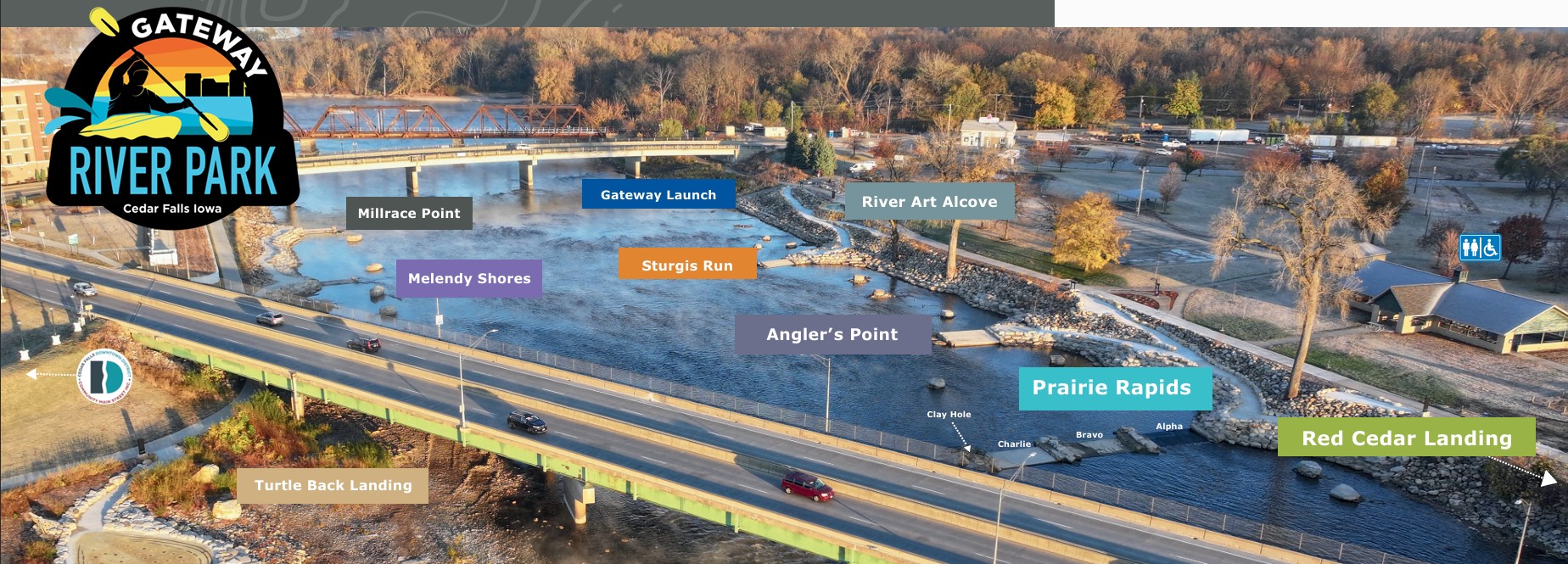
The Prairie Rapids are the focal point of the park with excellent access and “hang out” locations in the vicinity of the features. This area has proven to draw users of all types and not just the instream fun hogs!
Feature descriptions with initial suggested cfs levels
It should be noted that Alpha/Bravo/Charlie features are formed by in-river concrete slabs and can have a shallow water depth so flip/roll with caution.
Alpha is prime from 5600 CFS down to 2200 CFS. It provides a very good wave/hole that can be used by all instream users. At the upper level it can be very “rowdy”, yet still incredibly user friendly. The eddy on both sides are well defined and obtainable at all levels.
Bravo is prime from 6k CFS down to 3200 CFS. The eddies are well defined, but at upper levels are fast with mixed current (intermediate user level). 5600 CFS to 3700 CFS is a good surf level and the feature is best for smaller play kayaks and surfboards.
Charlie is best 8k CFS to 4k CFS. The river left eddy of Charlie is sharp at these levels, but still very obtainable. It provides fun water down to 2800cfs then fades.
Clay Hole shows up at 4100 CFS and completes the “Quad Fecta” of Prairie Rapids. It is playable at 4k CFS and surfable at 3600 CFS. It provides playboating fun as low as 1300 CFS and can be surfed as well. The hole behind the foam pile is deep enough for vertical moves down to 2k CFS. The downstream section comes up fast (20 feet downstream from the seam) so a fast roll is needed.
Source of above image and feature descriptions: GatewayRiverPark.com
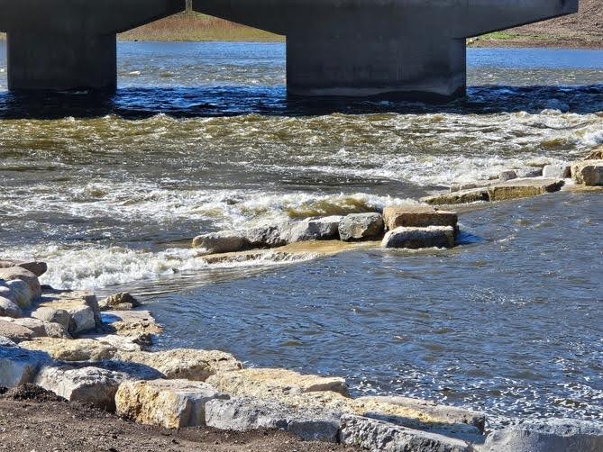
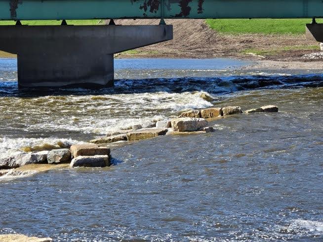
The above photos show the features at 2900 cfs
Put in and Take Out GPS Location: 42.538208, -92.442334
USGS guage: This USGS guage is located in Cedar Falls Iowa.
Current ft: 79.59Current ft^3/s: ICE